Property and Land Development Projects
Click on the tabs below to read more about the services we offer for Land Owners, Land Developers, Architects, Engineers, Town Planners, Project Builders and Contractors.
Our Services
- Detail Surveys
- Boundary Identification Surveys
- Disclosure Plans
- Engineering Setout Surveys
- As-Constructed Surveys and Preparation of Plans
- Survey Plans
Detail Surveys
Our focus is on providing information critical for efficient and cost effective building and infrastructure design on your development property.
In response to the modern trend of increasing densities our procedures emphasise increased attention to the accurate location of existing:
- Features
- Services
- Topography
We combine this survey information with in depth advice on both the physical and regulatory constraints affecting the property in order to achieve a successful design for the developer.
By utilising the latest field data acquisition and processing software we are able to provide both cost effective and on time solutions that meet our client’s expectations.
We take into account the level of detail required based on the site characteristics and tailor our service to the provide the optimal result for your project.
Our Detail Surveys will typically show the following features:
- Existing infrastructure
- Physical boundary features
- Site Dimensions
- Access and road details
- Visible services and details of pipes, invert levels etc
(Available as-constructed information on Power, Water, Telecomms, Sewer and Stormwater)’ - Contours and height information on AHD datum
(Significant vegetation, including information on tree height and size) - Setbacks to adjacent buildings, where possible
- Easements and encumbrances, where applicable
(We supply data in digital formats eg (PDF, DWG, DXF) of as per your requirements)
Boundary Identification Surveys
Determining the location of the legal position of the cadastral boundary is fundamental for the design and implementation of any successful land development project.
Our approach is to provide cost efficient, sensible advice regarding boundary locations tailored to your specific project requirements.
Including (where required):
- Investigation of encroachments
- Replacing missing boundary marks and
- The preparation lodgement of Identification Survey plans with Dept of Natural Resources when required in accordance with the requirements of the Land Survey Act 2003.
- Boundary locations are a common cause of disputes between neighbours, particularly when it comes to construction close to a dividing boundary. Existing site features such as fences and retaining walls are often not a true representation of the actual boundary position, and should not be relied upon as depicting the property boundary line. Ensure you know exactly where your boundary is with the completion of an Identification Survey.
- It is important to take into consideration the 3 dimensional aspect of encroachments, problems often occur above and below ground level.
- Don’t risk your next project to the consequences of encroachments, resulting in potential lengthy and costly legal disputes.
- Contact us today for advice on the boundary location of your property.
Disclosure Plans
We will prepare disclosure plans for you that satisfy the requirements of the Land Sales Act 1984.
- In order to market the lots in your new development during the development stage prior to registration, a disclosure plan needs to be attached to each contract.
- In terms of the Land Sales Act 1984 these plans are required in those instances where the reconfiguration comprises of more than 5 lots.
- The Act lays down specific requirements for the preparation of these plans and we have significant experience in meeting these requirements
Engineering Setout Surveys
 Our surveyors have the experience to determine the most cost efficient methodology required to setout your project.
- We understand the time critical nature of these projects and our flexible approach means that we work with you to achieve tight deadlines.
- We combine the latest field based software and technology that allows us to directly access your latest design drawings on site.
- This technology enables a visual confirmation of the setout points in real time with the added benefit of reduced chance of error due to misinterpretation of dense detail on paper prints.
As-Constructed Surveys and Preparation of Plans
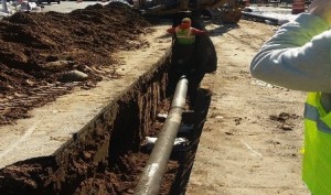 Local Authority approvals contain increasingly onerous as-constructed survey documentation requirements that need to be prepared and lodged prior to the final project sign off.
- Our surveyors are experienced in sourcing and preparing the as-constructed information to formats that comply with the individual requirements of the various local councils in SE Qld.
- We arrange with your site foreman to access the as-constructed information as soon as practically possible after the feature is installed in order to prevent delays around the completion date and also confirm compliance well before the project completion date.
Preparation of Survey Plans for Registration and Lodgement of Survey Plans for Sealing
Your development process leads to the final and crucial stages being:
- Preparation of the Survey Plans required to register the new lots with the Registrar of Titles at the Department of Natural Resources and Mines.
- The sealing of the Survey Plan by the local planning authority certifying that all the development conditions have been complied with.
We liaise with you so that these actions can occur as soon as practically possible following compliance with the development conditions
- We prepare the survey plans required for registration of your new lots with the Registrar of Title at the Department of Natural Resources and Mines. These include:
- Standard Format Plans
- Building Format Plans
- Volumetric Format Plans
- And for the registration of secondary interests:
- Lease Plans
- Exclusive Use Plans
- Easement Plans
- And the various types of Sketch plans required by your solicitor or conveyancer
- Service Location Diagrams
- Lease of Building Plans
- These plans go through our rigorous QA process to ensure that they conform with the Registrars requirements and also that the survey complies with the provisions of the Land Titles Act and the latest Cadastral Survey Requirements as laid down by the Department of Natural Resources and Mines.
- We will also advise you on the requirements of the local authority regarding the sealing of the these plans prior to being lodged with the Registrar and;
- We prepare and lodge the application for the plan sealing.